
Technically speaking, the northwest buttress of Tenaya Peak is more of a climb than a scramble, with 14 pitches of 5.0 to 5.5 climbing on clean, white granite. With climbing shoes and helmet but no rope or rack, Beth and I would be free soloing the route. Although free soloing might appear risky to non-climbers, we knew we’d be climbing well within our ability. Based on route beta and feedback from climbing friends who know us and the route, we felt comfortable with our decision. You can read more about the question of climbing without a rope and protection in this article about soloing Chapel Pond slab, a route that Beth and I have often considered soloing.


Not long after crossing the stream, we shoed up, switching from hiking boots to climbing shoes. For climbers, that’s the moment of truth: equal parts excitement and no-turning-back nervousness. The first half of the climb was fun, easy climbing following big overlaps, flakes and corners. Comfortable ledges were plentiful, and the views competed with the climbing for our attention, with Tenaya Lake spread out below and the peaks and domes of Yosemite’s high country unfolding in every direction.


At the halfway point, the climbing paused for a moment at the base of the huge amphitheatre to climbers’ left (east). A few snowfields still lingered, easily bypassed. Above this point the climbing steepened and became a notch or two more difficult. Not far above the snowfields, I took a line too far left that felt harder than I was comfortable with, so we down-climbed a half pitch and crossed over to easier terrain on the right.


The upper pitches have more exposure, following a line that at times is not far from the edge of the huge amphitheater. At one point, not far below the summit, I felt a bit uncomfortable with the exposure, but with confidence in sticky rubber and knowing that the two or three moves in front of me were no harder than 5.2-ish, I focused on the rock in front of me rather than the thousand feet of air that seemed directly below, and seconds later we stood on a welcoming ledge big enough for a picnic table. I think I kissed that ledge, but Beth just shrugged it off, apparently unphased by the exposure on that pitch. One more pitch zig-zagged us up some horizontal cracks and we popped out on Tenaya’s summit ridge, just a hundred feet or so east of the summit proper.


Tenaya Peak’s position near the center of Yosemite National Park gives it a commanding view. There are a lot of nice summits in Yosemite, this is one of the nicest.


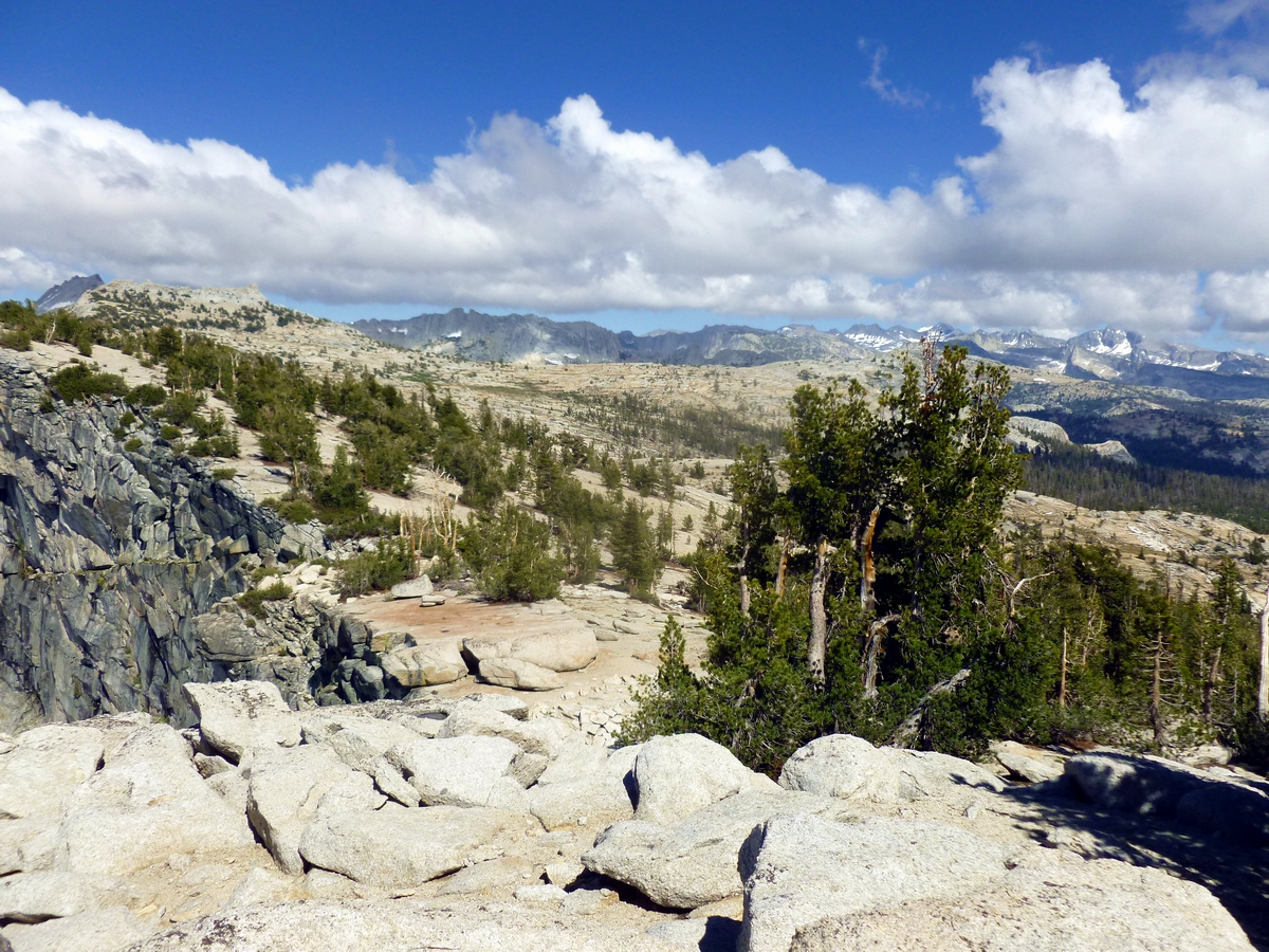
The backside of Tenaya is surprisingly gentle, and that wide open terrain figured into our plans for the second half of our day. From the summit, we had the option of descending a climbers’ path back to our parked car at Tenaya Lake, but in my experience these descent routes are often not a lot of fun. Instead, we decided to strike a line due east, traversing easy cross-country terrain to the saddle between Tresidder Peak and Columbia Finger, then dropping down into Cathedral Pass to pick up the John Muir Trail for a 5-mile hike back out to the Tioga Pass road.


The cross-country terrain turned out to be a piece of cake, and we were rewarded with the double bonus of a small stream for re-filling our water bottles (we each went through 2-3 litres on the climb) and a fantastic close-up view into the heart of the Cathedral Range from the top of the saddle. Next time it would be fun to add a quick scramble to the top of Tresidder’s south peak or the Columbia Finger (both are just a pitch or two of low 5th class climbing). Just as Beth was beginning to question my route finding ability, we intersected the JMT, exactly where I had intended. Never doubt an Eagle Scout with a map and compass!


The one minor hitch in our plan was that the JMT would deposit us at Tuolomne Meadows, 7 or 8 miles from our car at Tenaya Lake. There is a free shuttle bus that runs every half hour, but we popped out of the woods at 7:15 and as luck would have it the last shuttle was at 7:00. Figuring that we’d have no trouble catching a ride, we stuck out our thumbs. After a half hour of sparse traffic and no hits (not to mention approaching darkness), a Swiss tourist picked us up. We thanked our lucky stars that Europeans haven’t rejected hitchhiking as a legitimate transportation mode to the extent that Americans apparently have. There was a silver lining to our end-of-day SNAFU: we had reservations at Tioga Pass Resort, a wonderful colony of 10 rustic cabins located at 9,600’ just outside Yosemite’s eastern entrance. Rather than facing a 2-hour drive back to Wawona, we had a 15 minute drive to TPR and walked into their café minutes before the kitchen was set to close. Showers could wait, cold beer and the grilled meatloaf sandwich I had never tasted so good.
Awesome....each your posts seems to out-do the previous one in terms of awesomeness! This one borders on crazy! I got a little nervous just reading it and looking at the pics.
ReplyDeleteThanks Ken! I really enjoyed writing up this report.
Delete