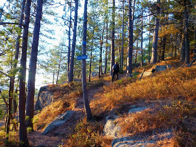
With family visiting for the weekend, we took advantage of two Lake George Land Conservancy preserves so that we could stay close to home base in Bolton Landing.
Nearby Thomas Mountain is my go-to hike for times when I've got just an hour or two to squeeze in a hike or trail run, and I headed up late in the day on Saturday with my brother to catch the sunset.
Last of the sun's rays illuminate the viewpoint ledges
The sun just about to dip below the horizon behind Crane Mountain
It's a quick hike up the blue trail to the viewpoint ledges below Thomas Mountain's summit, and we arrived just in time to see the sun drop behind Crane, Gore and the other mountains of the southern Adirondacks that make up the western horizon. Just enough clouds remained in the sky to reflect back the sun's golden glow.
After the sun dipped below the horizon, we hiked the short remaining distance to Thomas Mountain's summit proper. There we could look out over Lake George in the shadows below while the western sky turned from gold to rosy pink.
Crane Mountain
Enough light remained in the sky that we could hike down the jeep road to complete our loop without headlamps. Total time to cover the 2.5 mile round trip was a little more than an hour.
On Sunday we explored Amy's Preserve, a recent (2012) acquisition by the LGLC that protects 500 acres of ponds and wetlands that form the headwaters of Indian Brook, an important tributary of Lake George.
Trail up High Nopit
View of Pole Hill and Lake George
I was especially interested in checking out the short trail up High Nopit, a small (1600') mountain that overlooks Lake George. The red blazed trail climbs around 500' vertical in a mile to reach the summit ledges. Now, I have to get this out of the way up front: I have no idea what the name "Nopit" refers to. If anybody knows the meaning behind the name of this mountain, please add to the comments below.
Panorama from High Nopit
Like Thomas Mountain, High Nopit is an easy climb with a great view that is well suited to families. One word of caution: the trail was established only about a year ago, so the tread is rough in a few places. It will improve as the trail gets hiked in. Additionally, there is an alternate route blazed with yellow markers that you may wish to avoid. We hiked down the yellow trail, and it is very steep with loose footing. Our kids did fine, but most parties will prefer the red trail.
Coming down the steep Yellow trail
Surprising to see this small flower still in bloom
After coming down from High Nopit, we hiked out to some of the wetlands that make up Amy's Preserve. There are several trails from both Padanarum Road and Trout Falls Road, as well as two boat launch sites. Beth and I are planning to come back this winter: the entire area looks to hold excellent potential for cross country skiing. There's also interesting potential for a connection to adjacent state Forest Preserve land (the Pole Hill parcel) to the south and east. Pole Hill not only offers additional views of Lake George and surrounding mountains (disclosure: I haven't been there), it also could provide an interesting connection to the Tongue Mountain trail system - the resulting trail network would be quite impressive.
As you can see, quite a bit of color remains in the Lake George area as of last weekend. At least some foliage should remain for the coming weekend, but late fall is closing in fast. Soon (hopefully) the ground will be white and ski season will be upon us.


Wonderful! Gorgeous!
ReplyDeleteThanks! We have certainly been blessed with great weather for being outdoors this fall.
ReplyDeleteGreat photos!
ReplyDeleteNew trail to hikers. But 'heads up,' it's a popular area for hunters. Rifle season opens this weekend. Wear bright colors at least, put some blaze on your dog.
ReplyDeleteThanks for the reminder about hunting season.
Delete