
Our climb up the Bennie's Brook Slide to Lower Wolf Jaw mountain almost didn't happen. We made it to the trailhead fine (and scored the last available parking spot at the Garden trailhead), hiked uneventfully up the Southside Trail for three miles, and began ascending what we thought was the tributary that would lead us to the base of the slide...
The Bennie's Brook Slide route up Lower Wolf Jaw is a great introduction to slide climbing. The slide itself is moderate and not too difficult to locate. The round trip hike is 11 or 12 miles, short by Adirondack High Peaks standards. The slide is accessed from the Southside Trail, a beautiful alternate approach to the peaks in the Johns' Brook Valley. As the Southside trail ascends the brook valley, it remains close to the brook and there are frequent views of enticing pools and small falls.

Around three miles in, the Southside Trail crosses Bennie's Brook, a small tributary of John's Brook. The trick in locating the correct tributary is to count stream crossings along the Southside Trail: Bennie's Brook is the third tributary. As a fail-safe, not far beyond Bennie's Brook, the Southside Trail crosses a much larger tributary on a large wooden bridge; if you reach this bridge you've gone one tributary too far. A roughly 40 minute bushwhack up Bennie's Brook through open woods leads to the base of the slide.
Our error today occurred in identifying the correct tributary, and we began ascending the fourth rather than the third tributary. Eventually, we became convinced that we were not on the correct route and we traversed across the slope to intersect Bennie's Brook. Let's just say that there were some tense moments as we thrashed through the understory trying to get back on route, and leave it at that.

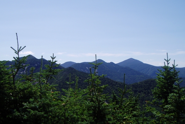
Once we intersected Bennie's Brook it became obvious that we were now on the correct route and we quickly reached the foot of the slide. The bottom of the slide is a low-angle, smooth, narrow corridor up the slopes of Lower Wolf Jaw. As you ascend, the slide widens and steepens, and views open up back across the Johns Brook Valley towards Big Slide Mountain and The Brothers range.

For the most part, the slide is clean bedrock that makes for easy climbing, but there are places where vegetation is beginning to take hold again. In time, the Adirondack forest will reclaim the slide path.
Eventually, the slide splits into right and left forks. The recommended route ascends the right fork. Near the very top of the slide, the slide steepens and narrows quite a bit and is filled with loose rock and vegetation. A short herd path leads from the top of the slide through the woods to intersect the Range Trail just below the summit of Lower Wolf Jaws. Once on the Range Trail, views open up through the trees towards Giant, the Dix Range, and other summits to the east. A ten minute hike leads to Lower Wolf Jaws' summit, elevation 4175 feet.

The true summit of Lower Wolf Jaws is mostly forested, but there are some excellent lookouts towards Algonquin and the MacIntyre Range, Colden, Marcy, and the peaks of the Great Range. The view up the Great Range from Lower Wolf Jaws' summit is an interesting perspective, with Upper Wolf Jaws, Armstrong, Gothics, Saddleback, Basin, Haystack and Marcy all visible in succession. The beautiful vista from the summit in today's outstanding visibility was a nice reward for our efforts climbing the slide.

Following the Southside Trail back to the garden, the afternoon sun shone directly down Johns Brook, illuminating the pools and falls in beautiful afternoon summer sun. We couldn't resist a brief stop to soak our feet in one of the inviting pools. These pools would make an excellent swimming destination for a family hike, so we've added the Southside Trail to our list of possible hikes with the kids.

We arrived back at the car at just under the 7 hour mark from when we left this morning. Total round-trip mileage is between 11 and 12 miles with a 2600' elevation gain from trailhead to summit.
Anonymous said...
ReplyDeleteIs that down tree still in the way after the split on the right slide
August 23, 2010 10:14 AM
Fujative said...
I just got back from a 3 day Backpacking trip over on Colden, Algonquin, and Wright. I have to write up a TR still but I should have some pictures of this peak from the Algonquin or Colden perspective.
August 23, 2010 3:13 PM
Harvey44 said...
Nice report all the way around. I'm trying to imagine how Wolf Jaws got it's name. Any clues or info? I'm imagining a range of mountains as the bottom teeth...but that would be more than one peak.
August 23, 2010 3:44 PM
Highpeaksdrifter said...
Nice report, I haven't done it yet.
August 23, 2010 3:58 PM
Tabe said...
This makes a much nicer ski than hike.Good for any skill level,just go as far as your comfortable.
August 23, 2010 6:00 PM
Jeff said...
There is a tree down in the narrow upper reaches that was easy to duck under on our climb but might provide more of an obstacle for a ski descent.
Fuj: Write up a TR and post it with some pics in the Forum.
Harv, the view of Upper and Lower Wolf Jaw Mountains from the Saint Huberts (Ausable Club) area is said to resemble a wolf’s mouth pointing skyward, with the notch between the two peaks forming the mouth. It takes a bit of imagination to see the resemblance, but I like the name anyway. According to the Adirondack 46ers publication “Of the Summits, Of the Forests,” those 2 peaks received their name from a reference in Alfred Street’s book “The Indian Pass” published in 1869.
Tabe points out that this is an excellent backcountry ski destination. Indeed, this is a well-known and popular route, so we are not giving away anyone’s secret stash by providing this information. The woods along Bennie’s Brook between the Southside Trail and the base of the slide have been sufficiently cleared of downed trees and branches to provide some nice tree skiing at a moderate pitch. As mentioned, the slide itself is a moderate slope but the pitch increases as one ascends. It should be noted that snow conditions on any slide can vary dramatically from surrounding conditions as a result of exposure to sun, wind scour, ncp, ice flows over rock, etc. I have personally not skied the Bennie’s Brook slide, but I know quite a few who have, perhaps someone might start a thread on the Forum and post some winter ski photos there.
August 26, 2010 12:33 PM
Anonymous said...
Here's the tree
http://i556.photobucket.com/albums/ss4/skioffpiste/08-09/Dacks010.jpg
August 26, 2010 5:17 PM
Harvey44 said...
ReplyDeleteHot linked: the tree August 26, 2010 5:49 PM
skimore said...
I would also comment that those lower woods can be tough going with more than few inches of fresh due to the pitch
August 26, 2010 10:59 PM
Jeff said...
Incidentally, here's a link to some nice winter ski shots of the Bennie's Brook slide that I recently came across.
September 26, 2010 11:08 PM