Thursday, September 15, 2011
Cliff Mountain: 08/11/2011
We had a bit of a backlog of trip reports to clear, but the following is a short fifth report in a series on women hiking the High Peaks. To keep things moving, I agreed to write this report, even though I wasn't along for the hike. -Jeff
Marcy at the Lake Colden outlet dam
The original plan for this trip was to climb both Cliff and Redfield in a day, since both peaks use the same approach. Four hikers (Beth, Marcy, Judy and Judy's friend) met early at the Upper Works trailhead to begin the long hike via Flowed Lands and Lake Colden to the Uphill Brook lean-to, located just below the start of the herd paths to Cliff and Redfield at around 3200’ elevation.
Mount Colden
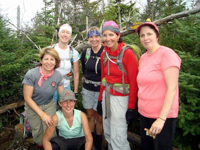
At Uphill, the four ladies met up with friends Carol, Helen, Elizabeth and Marie, who had hiked in the previous day and camped overnight. They had already climbed Redfield that morning, so the combined group of eight headed for Cliff.
The Opalescent above Lake Colden
Thankfully, the herd path to Cliff is short, just under a mile and a half each way. What it lacks in distance however, it makes up for in difficulty, and the group soon discovered why Cliff is often notoriously referred to as "The Great Adirondack Vertical Swamp." Where the trail isn't wet and muddy it is steep. Often it is all three, as was the case today.
Cliff's herd path, before the swamp gets vertical
The actual summit is pretty unremarkable (in fact, it’s one of four 46er summits lower than 4000’ elevation), but along the way there are some good views of Colden, Redfield and Marcy.
The southeast face of Colden and its slides
Marcy's summit catches some sun
Despite a promising forecast, clouds lingered for most of the day in the High Peaks, and occasional light showers kept the woods damp and the air cool. By the time the group made it back from Cliff’s summit to the Uphill lean-to, they realized that it would be too much of a stretch to try to get Redfield that day. The rough trail up Cliff, the weather, and the long approach (7.5 miles each way between the trailhead and the Uphill lean-to) conspired against the hikers, and after a short break at the lean-to, it was time to head back down the Opalescent towards the trailhead. Even without doing Redfield, it was a 12 hour, 18 mile day.
Cliff's viewless summit
Since Beth still needs Redfield, we're thinking of doing it as a winter peak by skiing to the Uphill lean-to and then climbing the peak. And if Beth ever wants to climb Cliff again, there's an interesting slide route that starts just a bit further in. Cliff is nobody's favorite peak, and there’s really no compelling reason to climb it unless you’re climbing the 46. But then again, I’ve learned to never say never.
Suspension bridge over the Opalescent on the way out
Footnote: Not long after the Cliff hike, Judy returned to get Redfield, and on Saturday, September 3 she climbed the final peak towards her 46 – Seymour. Congratulations Judy!
Cliff Mountain, elevation 3960', order of height: 44, first ascent NYS Surveyor Arthur Hopkins, 1921. Approximate round-trip mileage 18 miles, 2500 vertical feet.
Previous Women and Hiking entry: Santanoni Range
Labels:
46er,
High Peaks,
Hiking,
Women and hiking
Subscribe to:
Post Comments (Atom)


No comments:
Post a Comment